KGeoTag
Kategorijos: Graphics Photography
A photo geotagging utility
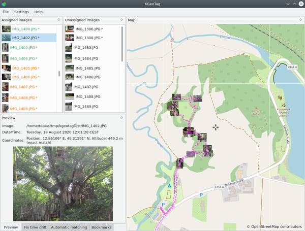
KGeoTag is a standalone geotagging program. Images can be associated with geographic coordinates by different means: On the one hand, a matching with GPX encoded geodata can be done, on the other hand, the coordinates can be set manually, either via drag and drop onto a map, via bookmarks or by manually supplying them. The coordinates can be stored in the images' Exif header and/or in XMP sidecar files.
Nėra oficialių „openSUSE Leap 16.0“ paketųPlatinamieji paketai
openSUSE Tumbleweed
SLFO 1.2
Nepalaikomos platinamųjų paketų versijos
Šie platinamieji paketai nėra oficialiai palaikomi. Už šių paketų naudojimą atsakomybę turėtumėte prisiimti patys.
